
Phuket (formerly known as Tha-Laang or Talang) is one of the southern provinces (changwat) of Thailand. Neighbouring provinces are (from north clockwise) Phang Nga and Krabi, but as Phuket is an island there are no land boundaries. The island is served by Phuket International Airport, located in the north of the island.
History
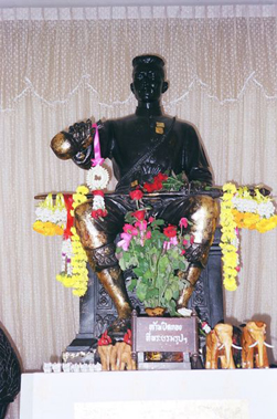
The most significant event in the history of Phuket was the attack by the Burmese in 1785. Captain Francis Light, a British East India Company captain passing by the island, sent word to the local administration that he had observed Burmese forces preparing to attack. Khunying Jan, the wife of the recently deceased governor, and her sister Mook then assembled what forces they could. After a month-long siege, the Burmese were forced to retreat March 13, 1785. The two women became local heroines, receiving the honorary titles Thao Thep Kasatri and Thao Sri Sunthon from King Rama I. During the reign of King Chulalongkorn (Rama V), Phuket became the administrative center of the tin-producing southern provinces. In 1933 Monthon Phuket was dissolved and Phuket became a province by itself. Old names of the island include Ko Thalang.
Geography
Phuket is the biggest island in Thailand, located in the Andaman Sea off southern Thailand. The island is mostly mountainous with a mountain range in the west of the island from the north to the south. The mountains of Phuket form the southern end of the Phuket mountain range, which ranges for 440 km from the Kra Isthmus. The highest elevation of the island is Mai Thao Sip Song (Twelve Canes), at 529 m above sea level.

70% of the island is covered by forest. The western coast has several sandy beaches, while on the east coast beaches are more often muddy. Near the southernmost point is Laem Promthep (Brahma's Cape), which is a popular sunset viewing point.
In the mountainous north of the island is the Khao Phra Thaeo Non-hunting Area, protecting more than 20 km² of rainforest. The three highest peaks of this reserve are the Khao Prathiu (384 m), Khao Bang Pae (388 m) and Khao Phara (422 m). The Sirinat National Park on the northwestern coast was established in 1981 and protects an area of 90 km² (68 km² marine area), including the Nai Yang beach where sea turtles lay their eggs.
One of the most popular tourist areas on Phuket is Patong Beach on the central western coast, perhaps owing to the easy access to its wide and long beach. Most of Phuket's nightlife and its cheap shopping is located in Patong, and the area has become increasingly developed. Patong means "the forest filled with banana leaves" in Thai.
Other popular beaches are located south of Patong. In a counterclockwise direction these include Karon Beach, Kata Beach, Kata Noi Beach, and around the southern tip of the island, Nai Harn Beach and Bang Tao Beach. These areas are generally much less developed than Patong, and sought out by individuals, families and other groups with a preference for more relaxed and less crowded environs than Patong.
There are several coral islands to the south of Phuket, the Similan Islands lie to the north west, and Phi Phi Islands to the south east. All the islands are suitable for diving.
Administrative divisions
Phuket is divided into 3 districts (Amphoe), which are further subdivided into 17 subdistricts (tambon) and 103 villages (muban).
- Mueang Phuket
- Kathu
- Thalang
There are 9 municipal (thesaban) areas within the province. The capital Phuket has city (thesaban nakhon) status, and the main touristical town Patong has town (thesaban mueang) status. There are further 7 townships (thesaban tambon) - Karon, Kathu, Thep Krasattri, Choeng Thale, Ratsada, Rawai and Wichit. The non-municipal areas are administrated by 9 tambon administrative organizations (TAO).


No comments:
Post a Comment