สายลมที่หวังดี - สุเมธ

Geography

Phitsanulok province covers some 10,584.5 sq. km. The riverside provincial capital is 377 km. North of Bangkok. Phitsanulok is situated on the geographical and administrative line uniting the central and northern regions. Phitsanuloke, located in Central Northern Thailand is a modern city. Ideal as a stepping stone for the Northern visitors attractions including Sukothai.
Phitsanulok was the birthplace of King Naresuan the Great of Ayuthaya (reign : 1590 - 1605), and his brother Prince Ekathosarot. Phitsanulok has long been an important center for political and strategic reasons. Phitsanulok was a major center of recruitment when Ayuthaya waged war with Burma, and was the capital of Thailand for 25 years during the 1448-1488 reign of Ayuthaya’s King Boromtrailokanat.
The climate of Phitsanulok is generally hot and humid. It borders with Uttaradit in he North, Pichit in the south, Loei and Phetchabun in the East, Kamphaeng Phet and Sukhothai in the West. Covering an area of 10,815.8 sq.km., the province is divided into 9 Amphoes : Muang , Bang Rakam , Nakhon Thai , Phrom Priram , Wat Bot - BangKrathum , Chat Trakan , Noen MaPrang , Wang Thong

City Attraction

Wat Phra Si Rattana Mahathat his monastery commonly called by the inhabitants as "Wat Yai" is the most important monastery of Phitsanulok, the home of the famous Phra Buddha Chinnarat. It is located at the foot of Naresuan Bridge on the city side of the river.The monastery was built in the reign of Phra Maha Thamma Racha I (Phraya Lithai) In 1357 A.D. It houses the Phra Buddha Chinnarat regarded as the most beautiful Buddha image in Thailand. It is cast in the attitude of subduing evil. Later, in 1631, King Ekatosarot graciously bestowed some of his gold regalia to be beaten into gold - plate and applied them to the image worth his own hands, creating its most beautiful Buddha image. There are many other beautiful and noteworthy items in the monastery compound. The mother - of - pearl inlaid wooden doors of Vihara are especially splendid, and were built by King Boromkot in 1756 as a dedication to phra Buddha Chinarat. Behind the Vihara, there is a large Prang 36 meters high, with a staircase leading up to the niche containing the Buddha relics. In front of the Prang, there is Phra Attharos, and on the 9 room Vihara slope. There remains only the newly-renovated Buddha image.
Wat Ratchaburana nad Wat Nang Phya Is located on the eastern bank of the Nan river, near Wat Phra Si Rattana Mahathat to the south. These two monasteries, assumed to be built when Phitsanulok City was ruled by King Boromtrailokanat, have linking compounds. Wat Nang Phya has temple or bot but it is known for the so-called "Phra Nang Phya" votive tablets special fine form of the 3-head nagas decorated on their eaves.
King Naresuan the Great Shrine The shrine is located in the compound of the Phitsanulok Phittayakom school, and depicts the seated king ceremoniously declaring Ayuthaya's independence from Burma. The shrine was constructed on the site of the Channdra Palace where King Naresuan was born in 1555.

Saturday, July 28, 2007

Wat Woranat Banphot


Wat Woranat Banphot (Khao Kop) is an old temple of the province on the peak of Khao Kop 185.5 meters above sea level. There are 2 ways up; a stairway of 439 steps and an asphalt road 3 meters wide. The peak has a replica of Lord Buddhas Footprint and a pagoda encasing the relic of Lord 
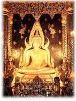
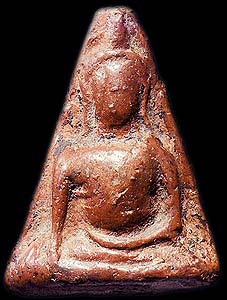
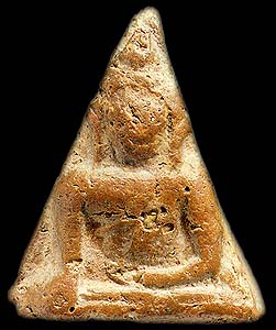
Buddha built when Sukhothai was the countrys capital. The temple was praised by the Department of Religious Affairs as the best development temple of 1966. A nearby hill is the site of some television relay stations.
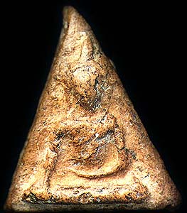

Getting There : Use Highway No. 32 (Asian Highway) and turn right onto Highway No. 117, then another right onto Highway No. 1 (old highway) into Nakhon Sawan Municipality. Turn left before reaching the municipality up Khao Kop. It is about 1 kilometer from the city.

Bung Boraphet


Bung Boraphet is the largest freshwater swamp in Thailand. It has an area of around 212 square kilometers. It covers parts of Amphoe Muang, Amphoe Tha Tako and Amphoe Chum Saeng. In the past Bung Boraphet was called the northern sea or Chom Bung as there was an abundance of aquatic animals and plants. According to surveys, there are still some 148 species of animals and 44 species of plants here. Rare animals include white-eyed river-martin and tiger perch.

During November to March a large number of waterfowls migrate here. Some parts of the swamp have been declared the Bung Boraphet Non-Hunting Area under the care of the Wildlife Conservation Division. Bung Boraphet is also a fish breeding ground where the Department of Fisheries has set up the Bung Boraphet Fishery Development Station.

Getting There: Bung Boraphet can be reached by many ways.
By Boat
From the Nakhon Sawan Municipal Pier Market, go north along Nan River for about 6 kilometers to the mouth of Bung Boraphet that is called Khlong Nong Duk. Go under the train bridge into the swamp.
By Car
Bung Boraphet Fishery Development Station Take the Nakhon Sawan-Chum Saeng route (Highway No. 225) for about 9 kilometers, then turn right for 2 kilometers to Bung Boraphet Fishery Development Station. Inside is a crocodile breeding pond and a freshwater aquarium. There are boats that you can charter on tours in the area at 400 baht per hour. The capacity is 15 persons per boat.

Bung Boraphet Non-Hunting Area or Waterfowls Park Take the Nakhon Sawan-Tha Tako route (Highway No. 3001) for about 20 kilometers and turn left for 4 kilometers to the park. The park has an exhibition in the form of a nature study center, a garden and accommodation. For more details, please contact the Bung Boraphet Non-Hunting Area or the Bung Boraphet Wildlife Conservation Promotion and Development Station, tel. (056) 227874. In addition, there are long-tail boats to take visitors around Bung Boraphet at 200 per boat.

Mae Wong National Park is on the Thanon Thong Chai Mountain Range. The area consists of winding mountains and is the source of several waterways, including the Mae Wong River and some parts of Khlung Canal. The waterways flow into the Ping River and the Chao Phraya River. Mae Wong National Park is in Amphoe Pang Sila Thong in Kamphaeng Phet (446.4 square kilometers) and in Amphoe Mae Wong-Mae Poen in Nakhon Sawan (446.48 square kilometers), totaling 892.88 square kilometers. The north borders Khlong Lan National Park of Kamphaeng Phet, the south borders Huai Kha Khaeng Wildlife Reserve of Uthai Thani, the east borders villages in Kamphaeng Phet and Nakhon Sawan, and the west borders Um Phang Wildlife Reserve in Tak. The area was proclaimed a national park on 14 September 1987 and was the 55th national park of Thailand. The park headquarters are at No. 65, Khlong Lan-Um Phang Road, Amphoe Pang Sila Thong, Kamphaeng Phet.

Attractions in Mae Wong National Park :
Kaeng Pha Khoi Nang-Kaeng Nam Bon Kaeo Hin is on the Khlong Lan-Um Phang road and 1.4 kilometers from the park headquarters and another 400 meters on a secondary road. This is a large brook that Khlung Canal flows through. From here, you can walk around 350 meters to Pha Khoi Nang Waterfall that has 4 levels.

Viewpoint is on the Khlong Lan-Um Phang road at Km. 81, around 16 kilometers from the park headquarters. At Km. 93 about 28 kilometers from the headquarters is the area between mountains that is perpetually breezy with an average temperature below 20 degrees Celsius. It is 1.34 kilometers above sea level.

Nang Nuan Waterfall can be reached by getting to Km. 93 and going on foot for about 6.4 kilometers. The waterfall is located amidst the lush jungle. It has 4 levels. It takes about 1 day to make a return trip to the waterfall.

Mae Krasa Waterfall is a large 9-level waterfall about 900 meters high. The waterfall is formed by streams from high-altitude jungles on the Thanon Thong Chai Mountain Range. It is about 18 kilometers from the park headquarters. The trip on foot takes 3-4 days.

Mae Riwa Waterfall is around 21 kilometers from the headquarters. It is a large waterfall that has 5 levels and takes about 3 days for a return trip on foot.

Mokochu Peak is the highest peak in the park. It is 1.964 kilometers above sea level and is 50 kilometers from the headquarters. The return trip on foot takes 5-7 days.

Kaeng Lan Nok Yung is a brook with a wide rock plateau. Mae Wong River, which originates in Mae Wong Forest flows through it. It is about 800 meters from Mae Rewa Forest Protection Unit. The area is suitable for training programs and group camping. The distance from the unit to the brook is about 1.5 kilometers and it is accessible by car.

Moreover, there is accommodation in the park. For information, please contact Mae Wong National Park, Khlong Lan-Um Phang Road, Km. 65, Amphoe Khlong Lan, Kamphaeng Phet, tel. 0-5671-9010-1 or the National Parks Division, National Resources Conservation Office, Royal Forest Department, Bang Khen, Bangkok 10900, tel. 0-2579-0529, 0-2579-4843.

Getting There : There are 2 main routes:
1. Bangkok-Nakhon Sawan-Lat Yao-Khlong Lan route into the park on Highway No. 1117 (Khlong Lan-Um Phang) at Km. 65.
2. Bangkok-Nakhon Sawan-Khong Wilai-Khlong Lan route into the park on Highway No. 1117 (Khlong Lan-Um Phang). The total distance from Bangkok to the park is about 386 kilometers.

Khao Tham Phra

Khao Tham Phra is at Mu 8 in Tambon Noen Sala. Inside are stalactites, stalagmites and Buddha images. During Songkran Festival locals will take flowers, candles and incense sticks up the 100 steps from the foot of the hill to pay homage to the images. A great view of Amphoe Krok Phra can be seen from the peak.

Getting There:Take the Nakhon Sawan-Krok Phra road for about 16 kilometers, then turn right onto the Krok Phra-Thapthan road for about 10 kilometers and a left into the cave for about 4 kilometers. The road is a laterite road. The total distance from the city is approximately 30 kilometers.

Khao No -Khao Kaeo


Khao No-Khao Kaeo is a limestone mountain that has Wat Khao Lo at its foot. A stairway leads to the cave at the peak where a large Buddha image sits in front. When King Rama V visited here via the Ping River, he stayed overnight on the mountain. The province later built a monument to commemorate the occasion. There are numerous monkeys at the foot of the mountain and you can see plenty of bats that live in the cave flying out to feed in the evening, making a long black line in the night sky. Khao Kaeo nearby also has a number of bats flying out at night.


Getting There : The mountain is beside the Asian Highway along the Nakhon Sawan-Kamphaeng Phet section in Tambon Ban Khaen. It is around 45 kilometers from the city and about 18 kilometers from the district center
.

Nakhon Sawan Province

Nakhon Sawan Province, also known as Pak Nam Pho is where the rivers of Ping, Wang, Yom, and Nan converge and form the Chao Phraya River, the most important waterway of Thailand.

Nakhon Sawan is in the lower northern part of the country between the North and the Central Region. It is regarded as the doorway to the North and it is the hub of transportation in the Lower North.

Boundary
Nakhon Sawan is situated on the bank of the Chao Phraya River. It has a total area of about 9,597 square kilometers and is 237 kilometers from Bangkok. It borders the following provinces:
  • North borders : Kamphaeng Phet and Phichit
  • East borders : Phetchabun and Lop Buri
  • West borders : Tak
  • South borders : Uthai Thani, Chai Nat, Sing Buri, and Lop Buri

The province is divided into 13 Amphoe (districts) and 2 King Amphoe (sub-districts) :

  1. Amphoe Muang
  2. Amphoe Krok Phra 18 kilometers from the city
  3. Amphoe Phayuha Khiri 25 kilometers from the city
  4. Amphoe Banphot Phisai 35 kilometers from the city
  5. Amphoe Kao Liao 20 kilometers from the city
  6. Amphoe Lat Yao 40 kilometers from the city
  7. Amphoe Tha Tako 50 kilometers from the city
  8. Amphoe Chum Saeng 39 kilometers from the city
  9. Amphoe Nong Bua 71 kilometers from the city
  10. Amphoe Tak Fa 70 kilometers from the city
  11. Amphoe Ta Khli 85 kilometers from the city
  12. Amphoe Phaisali 65 kilometers from the city
  13. Amphoe Mae Wong 94 kilometers from the city
  14. King Amphoe Chum Ta Bong 70 kilometers from the city
  15. King Amphoe Mae Poen 83 kilometers from the city

How to get there

By Car

From Bangkok, take Highway No. 1 (Phahon Yothin Road) to Km. 52 then Highway No. 32 (Asian Highway) past Phra Nakhon Si Ayutthaya, Ang Thong, Sing Buri, Chai Nat, and Uthai Thani into Nakhon Sawan. The total distance is about 240 kilometers.

By Bus

There are several regular and air-conditioned buses running daily between Bangkok and Nakhon Sawan. For more information, please contact the Northern Bus Terminal (Mo Chit), tel. 66 2279 4484-7 (air-conditioned).


By Train

The Northern Line runs many times a day from Bangkok through Nakhon Sawan and ends in Chiang Mai. For more information, please contact the Travel Service Division at tel. 66 2223 7010, 66 223 7020

Friday, July 6, 2007

Seal of Phichit Province


The provincial seal shows a pond, which refers to the old name of Phichit, Mueang Sra Luang (meaning city at the royal pond). The Banyan tree in front refers to the temple Wat Pho Prathab Chang. The temple was built in 1669-71 by King Luang Sorasak,who was born in the village of Pho Prathab Chang, between a Banyan and a Sacred Fig.
The flag of Phichit shows the circular provincial seal in the middle. It has three green bars and two white horizontal bars, with the middle bar being interrupted by the seal.
Provincial tree is the
Ironwood Mesua ferrea,provincial flower is the Lotus (Nymphaea lotus).

Phichit Province


Phichit is one of the provinces (changwat) of Thailand, located in the north of the country. Neighboring provinces are (from north clockwise) Phitsanulok, Phetchabun, Nakhon Sawan and Kamphaeng Phet.

Geography
The rivers Nan and Yom flow through the Phichit province, before they join shortly before the Chao Phraya is formed. The province mainly consists of low fertile river plains, making rice and lotus the main crops.


History
The town Phichit was established in 1058 by Phraya Kotabongthevaraja, and was first part of the Sukhothai kingdom, and later of Ayutthaya.

The name of the main city changed several times. At first it was called Sra Luang (city of the royal pond), in Ayutthaya times it was called Okhaburi (city in the swamp), and then finally Phichit (beautiful city).

Administrative divisions

The province is subdivided in 9 districts (Amphoe) and 3 minor districts (King Amphoe). These are further subdivided into 89 communes (tambon) and 852 villages (muban).
Amphoe


  1. Mueang Phichit
  2. Wang Sai Phun
  3. Pho Prathap Chang
  4. Taphan Hin
  5. Bang Mun Nak
  6. Pho Thale
  7. Sam Ngam
  8. Tap Khlo
  9. Wachirabarami
  10. Sak Lek
  11. Bueng Na Rang
  12. Dong Charoen