สายลมที่หวังดี - สุเมธ

Geography

Phitsanulok province covers some 10,584.5 sq. km. The riverside provincial capital is 377 km. North of Bangkok. Phitsanulok is situated on the geographical and administrative line uniting the central and northern regions. Phitsanuloke, located in Central Northern Thailand is a modern city. Ideal as a stepping stone for the Northern visitors attractions including Sukothai.
Phitsanulok was the birthplace of King Naresuan the Great of Ayuthaya (reign : 1590 - 1605), and his brother Prince Ekathosarot. Phitsanulok has long been an important center for political and strategic reasons. Phitsanulok was a major center of recruitment when Ayuthaya waged war with Burma, and was the capital of Thailand for 25 years during the 1448-1488 reign of Ayuthaya’s King Boromtrailokanat.
The climate of Phitsanulok is generally hot and humid. It borders with Uttaradit in he North, Pichit in the south, Loei and Phetchabun in the East, Kamphaeng Phet and Sukhothai in the West. Covering an area of 10,815.8 sq.km., the province is divided into 9 Amphoes : Muang , Bang Rakam , Nakhon Thai , Phrom Priram , Wat Bot - BangKrathum , Chat Trakan , Noen MaPrang , Wang Thong

City Attraction

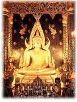
Wat Phra Si Rattana Mahathat his monastery commonly called by the inhabitants as "Wat Yai" is the most important monastery of Phitsanulok, the home of the famous Phra Buddha Chinnarat. It is located at the foot of Naresuan Bridge on the city side of the river.The monastery was built in the reign of Phra Maha Thamma Racha I (Phraya Lithai) In 1357 A.D. It houses the Phra Buddha Chinnarat regarded as the most beautiful Buddha image in Thailand. It is cast in the attitude of subduing evil. Later, in 1631, King Ekatosarot graciously bestowed some of his gold regalia to be beaten into gold - plate and applied them to the image worth his own hands, creating its most beautiful Buddha image. There are many other beautiful and noteworthy items in the monastery compound. The mother - of - pearl inlaid wooden doors of Vihara are especially splendid, and were built by King Boromkot in 1756 as a dedication to phra Buddha Chinarat. Behind the Vihara, there is a large Prang 36 meters high, with a staircase leading up to the niche containing the Buddha relics. In front of the Prang, there is Phra Attharos, and on the 9 room Vihara slope. There remains only the newly-renovated Buddha image.
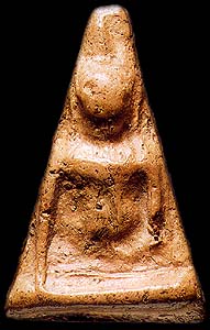
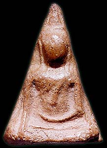
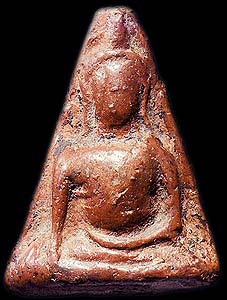
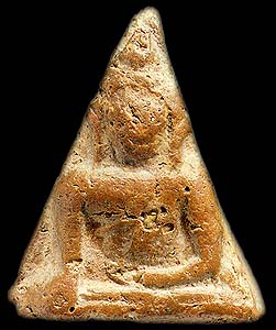
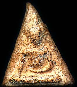
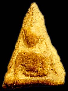
Wat Ratchaburana nad Wat Nang Phya Is located on the eastern bank of the Nan river, near Wat Phra Si Rattana Mahathat to the south. These two monasteries, assumed to be built when Phitsanulok City was ruled by King Boromtrailokanat, have linking compounds. Wat Nang Phya has temple or bot but it is known for the so-called "Phra Nang Phya" votive tablets special fine form of the 3-head nagas decorated on their eaves.
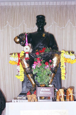
King Naresuan the Great Shrine The shrine is located in the compound of the Phitsanulok Phittayakom school, and depicts the seated king ceremoniously declaring Ayuthaya's independence from Burma. The shrine was constructed on the site of the Channdra Palace where King Naresuan was born in 1555.

Monday, February 25, 2008

Chiang Rai Hotel : The River House Resort & Spa


The River House features 30 spacious deluxe rooms and 6 junior suites, all with river view. Decor and furnishings are of elegant Thai design , with extensive use of traditional materials including woodwork and wooden floor to reflect facets of delicate Thai culture.


The River House features spacious 30 deluxe rooms (40.5 sq.m.) overlooking swimming pool and sparkling River Kok creating a rare scenic backdrop; and 6 junior suite with breezing private verandas to bring you nearest to the river and closer to the nature. In-room facilities include:

  • Bathroom with a bath tub and a separate shower
  • Safe-deposit box
  • Hairdryer, bathrobes, slippers
  • Full-sized sofa with coffee table
  • Mini bar, refrigerator, complimentary tea & coffee
  • 25" flat screen TV with cable network providing local TV channels as well as CNN, BBC, HBO, CINEMAX, Super Sports, and Discovery, etc.
  • Stereo sets for cassette, CD, and VCD
  • Distinct décor and furnishings of elegant Thai design atop wooden floor
At the River House, you can exclusively enjoy luxurious amenities in the midst of Chiang Rai’s serene nature and beauty.
You will be fascinated by the sight and sound of natural habitat and a spectacular panoramic view, especially at dawn and dusk times.


  • Right on the bank of The River Kok
  • 7 km from Chiang Rai Airport
  • 3 km from Chiang Rai City Center
  • 12 km to Santi Buri International Goft Course
  • 60 km to Thai - Burmese Border at Mae Sai District
  • Within 1 hour to many other places of interest e.g. The Golden Triangle, Doi Tung Royal Villa and botanical garden, Doi Mae Salong, Loh Chah Karen Village etc.

At the River House you can enjoy the luxury of

  • Full-sized swimming pool and outdoor jacuzzi
  • Fully equipped fitness room (river front)
  • Outdoor jogging track in the garden
  • Coffee Shop including Terrace and Poolside seating area's
  • Tara Restaurant offring selection of Thai and International Cuisine
  • Well stocked Bar
  • Library with internet access
  • Game room and snooker table
  • Spa treatment villa
  • Two meeting rooms (12 seats and 25 seats)
  • Complimentary shuttle van to night bazaa (7 pm - 10 pm)
Spend Your Days in Chiang RaiStay by the Romantic River Kok at the River House
"Experience the finest boutique resort in Chiang Rai."
Contact : 482 M.4 , Mae Kok Rd., T. Rim Kok, A. Muang Chiang Rai 57100 Thailand tel 66 53 750 829 to 834 Fax: 66 53 750 822

Saturday, February 16, 2008

Doi Luang National Park

Covers areas in Amphoe Phan, Amphoe Wiang Pa Pao of Chiang Rai and some part of Lampang and Phayao.
Topography
The area consists of high mountain range lying north and south. Doi Luang Mountain, in the north part, is the highest area. The area has laterite mixed with rock especially on the top and productive soil in the valley. The rock in this area is sandstone.
Climate
The weather is three season such as; Rainy season – from June to October Winter – from November to January Summer – from February to May.
Flora and Fauna
There are many kinds of forest in the area such as mixed forest, rain forest, and deciduous forest, which have the main plants, for examples, Sela (a kind of Lagerstroemia), ironwood, Kabok (a kind of Ixonanthaceae), Moulmein cedar, gangaw, Siamese sal, ingyin, Heang (a kind of Dipterocarpaceae), eng, many kinds of Fagaceae and bamboo. Animals found are barking deer, wild boar, beer, hare, palm civet, civet cat, flying squirrel, monkey, tiger and many kinds of bird.
How to get there
To get to the park is by taking Chiang Rai - Phayao Highway for 58 kms. to Ban Pu Kaeng, turn right at km. 773 for another 9 kms.
Contact
Doi Luang National Park Mae Yen district, Phan amphore, Chiang Rai province post code 57280, tel 053 609 042
and tourist service centre to serve everyday on 08:00-16:30.

King Mengrai


King Mengrai was born to the ruler of Ngoen Yang (in the region of Chiang Saen in 1239. His mother was a daughter of the Tai Leu ruler of Chiang Hung (Jinghong in Xishuangbanna Prefecture, Yunnan). The 25th in a line of Lao kings, he ascended to the throne in 1259.A charismatic and powerful leader, he quickly established dominance over the small neighbouring principalities.As his power increased he moved his capital to Chiang Rai, which he founded in 1262, and then to Fang in 1268. In 1276, he formed an alliance with King Ngam Muang, the powerful ruler of Phayao.King Mengrai captured the richer and more powerful city of Haripunchai (Lamphun) in 1281. He was able to do this through a conspiracy with a skilful merchant called Ai Fa, who won the confidence of the city's ruler and became chief minister. Ai Fa then undermined the king's popularity, bringing about the easy downfall of the city.

Mengrai gained further strength from his association with King Ngam Muang of Phayao, who had been tutored as a child with King Ramkamhaeng of Sukhothai. This helped Mengrai forge an alliance with the latter in 1287, securing his southern flank from attack and giving him a free hand to counter threats from the Mongol Chinese empire to the north.
At some time in the 1280's Mengrai moved his capital to Wiang Kum Kam, but the site later proved to be unsuitable. In the late 1280's he made two expeditions to Burma.
From the Mon kingdom of Hamsavati (Pegu) he gained an alliance and the hand of the king's daughter. From the Shan kingdom of Ava-Pagan he gained 500 families of skilled craftsmen.
Mangrai founded his grandest capital, Chiang Mai, in 1296 and began to embellish it with temples. His forces successfully campaigned against the Chinese Mongols in Southern Yunnan, but after 1311 he sent tribute to the Mongols and averted further threats from the north. He died in the middle of the city, reputedly from a lightning strike, in the year 1317.
Mangrai had three sons. The second son, Chai Songkhram, was to continue the dynasty that ruled Lanna until the demise of Phra Mekuti in 1564.

Monument of King Mengrai the Great This Monument is situated at the starting point of the road to Mae Chan, Chiang Saen and Mae Sai.

Seal of Chiang Rai Province

The seal of the province shows a white elephant, the royal symbol. It remembers that Chiang Rai was founded by King Mengrai, according to the legend because his elephant liked the place.
The provincial tree is the Tree Jasmine (Radermachera ignea), and the provincial flower is the Orange Trumpet (Pyrostegia venusta).
The provincial slogan says: "Northernmost in Siam, beautiful Doi Tung, repository of culture, most delicious rice, sweet and fragrant litchi, beautiful women, the finest flavored tea, pineapple".

Chiang Rai Province


Chiang Rai is the most northern province (changwat) of Thailand. Neighbouring provinces are (from east clockwise) Phayao, Lampang and Chiang Mai. In the north it borders Shan State of Myanmar and Bokeo and Oudomxai of Laos.


The average elevation of the province is 580 m. The north of the province belongs to the so-called Golden Triangle, at which the borders of Thailand, Laos and Myanmar converge - an area which was very unsafe because of the drug smuggling across the borders. The Mekong river forms the boundary with Laos, the Mae Sai and Ruak River to Myanmar. Through the town of Chiang Rai itself flows the Kok River.


While the eastern part of the province is relatively flat river plains, the western part consists of mountainous terrain. While not the highest elevation of the province, the 1322 m high Doi Tung (Flag hill) is the most important hill. The Wat Phra That Doi Tung temple on top of the hill according to the chronicles dates back to the year 911. Nearby is the Doi Tung royal villa, former residence of princess mother Somdej Phra Srinagarindra. Thanks to her activities the hills were reforested, and the hill tribes changed from growing poppy to other crops.


Chiang Rai became a province in 1910, after being part of the kingdom of Lannathai for centuries. After Lannathai was incorporated into Thailand, it stayed an autonomous region and thus the Chiang Rai area was administered from Chiang Mai.


The majorty of the population are generally ethnic Thai, but 12.5% of the population belong to the hill tribes, a minority in the North of Thailand. A minority are of Chinese descent, mainly descendants of the Kuomintang soldiers who settled in the region, notably Santikhiri.


Statistics
Capital : Chiang Rai
Area : 11,678.4 km²


Inhabitants : 1,129,701 (2000)
Pop. density : 97 inh./km²